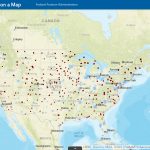
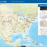
New Airport UAS Facility Maps provide useful information for commercial UAS pilots.
The FAA held a seminar to discuss the newly released Airport UAS Facility Maps. The seminar was presented by UAS leader, Jeff Riolo. Jeff Riolo is with Empower UAV. He is very knowledgeable in current FAA information, rules and regulations. These maps provide valuable information for a commercial UAS pilot. Maximum altitudes, Airport Date and Temporary Flight Restrictions and much more..
There are various ways to get to the Airport UAS Facility Maps … this link works best. This link will allow the full use of the information available.
- Airport UAS Facility Maps Use this link
- Read and agree to the terms
- Scroll down to “open” the program

The maps are used to provide information regarding maximum altitude, airport data and temporary flight restrictions. They are an aid used by FAA Part 107 processors to help with the airspace authorization process. The FAA released the first of several facility maps April 27, 2017. Additional maps will be published every 56 days through the end of the year. If you would like to see the chart of release dates. 56-day aeronautical chart production schedule.
Even though the maps show the areas and altitudes near airports, commercial drone pilots will still need to file for an authorization through the FAA portal. These maps will help with authorization process. They are to be used for planning and information only.

As of the first release only Class E airports are shown as grid. It is assumed with each release in the future additional airport classifications will be added. There are many features of the Airport UAS Facility Map, grids, charts, visual aids and data. All very useful.
The grid shows maximum altitude around an airport.
By selecting a specific area, valuable detailed information can be obtained.
- Airport ID
- Airport Name
- Region
- Ceiling
- Unit
- Class Airspace
- Latitude
- Longitude
- Map Effective Date
- Last Edit Date

Basemap Gallery has several views to chose.
12 From Canvas, Street views, Topo maps and more. Works great for UAS users that are more familiar with Google Earth or other mapping sources.
- Dark Gray Canvas
- Imagery
- Imagery with Labels
- Light Gray Canvas
- National Geographic
- Oceans
- Open Street Maps
- Streets
- Terrain with Labels
- Topographic
- USA Topo Maps
- USGS National Map

Layers can be added.
11 visual layers can be selected depicting UAS flight restrictions, UAS Facility map data, and Airspace Class. A simple “click” and you can see the visual of what type of information you need. UAS Flight Restrictions (shown in red) apply to all UAS flight operations, and remain in effect 24 hours a day, 7 days a week. There may be additional temporary flight restrictions that prohibit UAS and manned flight in effect in your area. See Temporary Flight Restrictions for additional information on flight restrictions that may be in effect in your area before operating your UAS.
- UAS Flight Restrictions
- UAS Facility Map Data
- Special Use Airspace
- Class B, C, D Airspace
- Class E2 -E6 Airspace
The maps are user friendly. They allow a user search for a specific airport and to zoom in or out. The Airport UAS Facility Maps easily show flight restrictions and minimum altitudes. Reminder…. this is not where you file for authorizations. You must file for Airspace Authorizations through the FAA online line portal.
The FAA offers seminars and a WINGS pilot proficiency program for further education and safety. Jeff Riolo did an excellent job discussing the details and the features available with the Airport UAS Facility Maps . Take a look and see the benefits it can offer you as a commercial UAS pilot.

